


News
December - Flood Control in Tokyo Metropolis Updated in December 2019
Many of Japan’s rivers are prone to flooding, and Japan itself receives plenty of rainfall via the annual rainy season (梅雨) and typhoons. This overabundance of water has been a problem in the Tokyo region for millennia, as several large rivers flow into Tokyo Bay, including the Tamagawa, the Edogawa, the Nakagawa, and the Arakawa. Japan’s second longest river, the Tonegawa, also used to flow into the bay until it was rerouted to the ocean via a 60-year engineering project beginning in 1594.
This project reduced the frequency of floods in and around the increasingly populous city of Edo or old Tokyo. But it would not be the last—the 22km-long Arakawa Drainage Canal (荒川放水路) was completed as recently as 1930.
One of the most visible preventative measures to the casual observer are the artificial riverbanks that line many of Japan’s rivers. These revetments come in a variety of designs and are designed to absorb the energy of flowing water, preventing erosion.
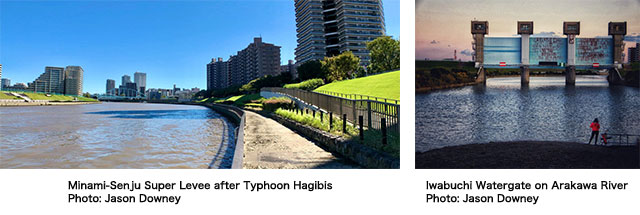
Levees are also common. These large structures are built up from sand, soil, rocks, and clay, and protect large sections of cities from being regularly flooded. Japan has also developed the Super Levee, and many now line the rivers of Tokyo. Though they take decades to build, super levees are more effective at mitigating floodwater, and more resilient against earthquakes.
Japanese engineers have also devised underground drainage channels to deal with overflowing rivers. The Kanda River runs through the middle of densely populated Tokyo, where expanding the river’s banks or building levees was impractical. Instead, engineers dug downward, and in 2008 completed the Kanda River / Ring Road No. 7 Underground Regulating Reservoir (神田川・環状七号線地下調節池), which can redirect roughly 540,000 cubic meters of excess water. This is just one of dozens of reservoirs underneath Tokyo.
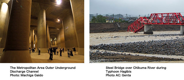
But perhaps the most impressive feat of engineering is just north of Tokyo, across the Saitama border in Kasukabe. There, 50 meters underground, is the world’s largest underground “river,” a series of tanks, tunnels, and pumps stretching over 6 kilometers: the Metropolitan Area Outer Underground Discharge Channel (首都圏外郭放水路). This gargantuan structure was completed in 2006 to drain excess water from the Nakagawa and Ayase River basins.
Ultimately, while these measures do save lives and homes, weather patterns across the world are becoming more volatile. Please see here for a list of flood hazard maps in the Tokyo and Osaka areas (some maps only in Japanese). They might come in handy when looking for an apartment in Tokyo. Please see here for a real-time flood information map of Japan (English & Japanese). Please see here for a searchable country-wide map that shows risks for flood, landslide, and tsunami (Japanese only).
On October 12, 2019, Typhoon Hagibis hit Japan, causing billions of dollars in damage, flooding over 10,000 homes, and resulting in the deaths of nearly 100 people. It was the strongest storm to hit the Kanto region since 1958’s Typhoon Ida which resulted in the deaths of 1,269 people.